


 Newsletter
 Online Store
 Login
Login


RACE INFO

RACE INFO
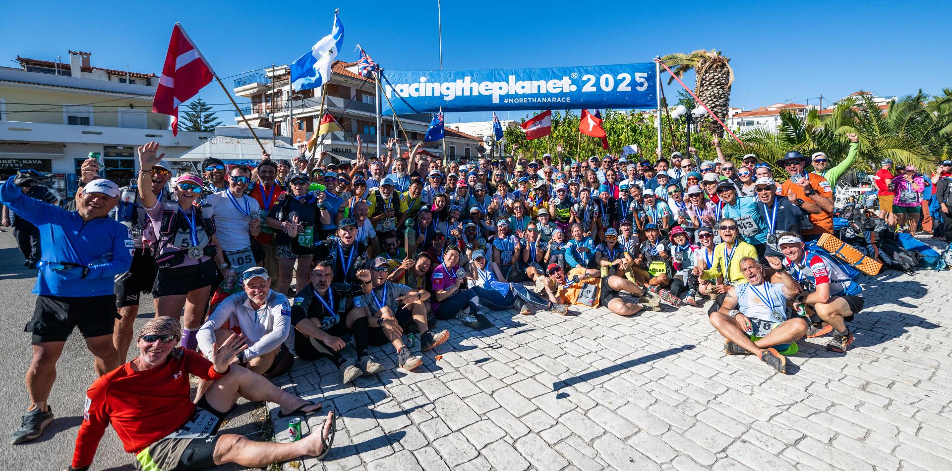
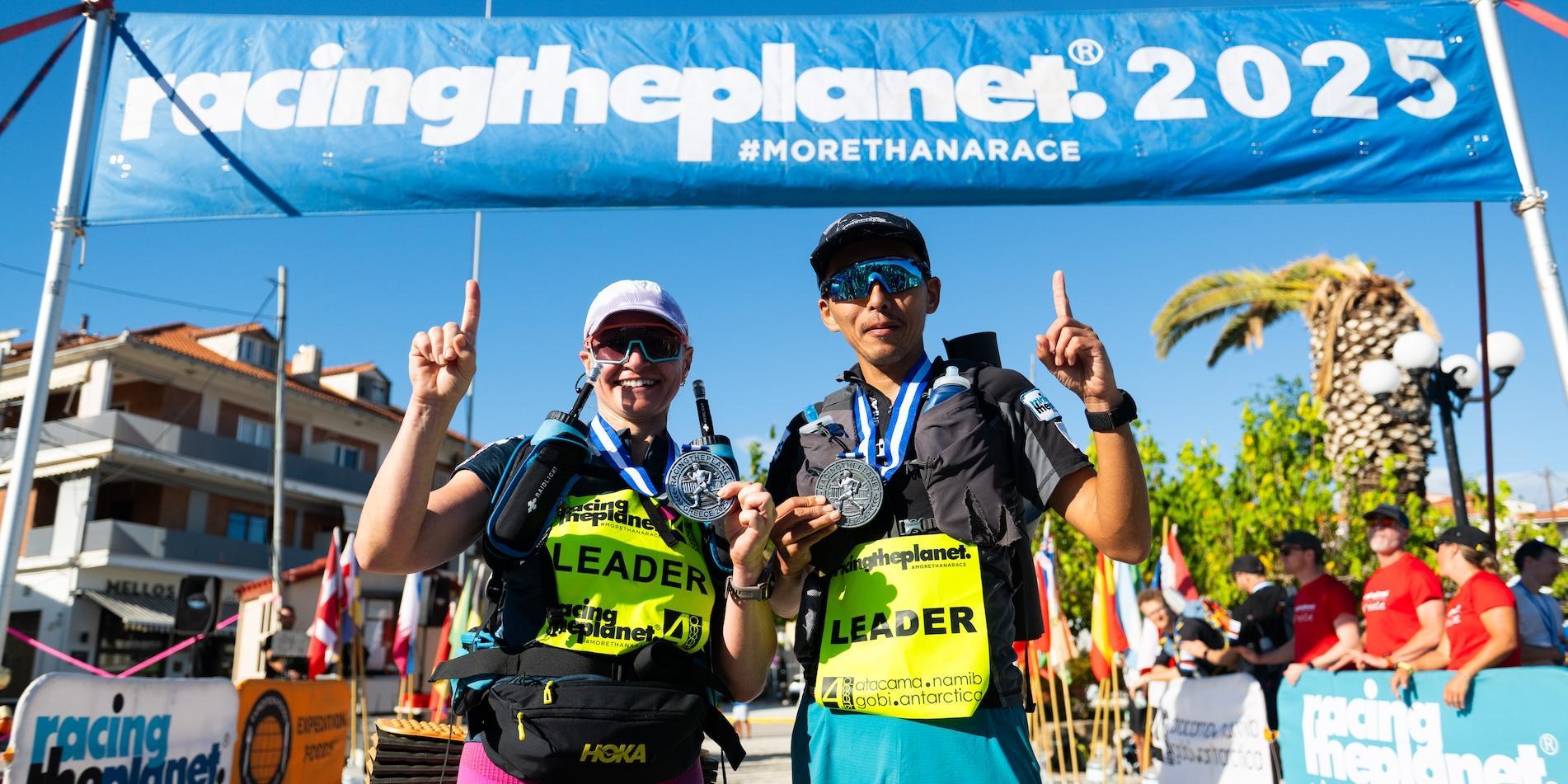
RacingThePlanet: Greece 2025 Course Description
RacingThePlanet: Greece 2025 is not just a race – it is an “Odyssey” ("a timeless voyage of self-discovery" - ancient Greek poet Homer). Covering 250 kilometers over seven days, competitors will traverse a landscape where history, myth, and natural beauty are combined.
The course takes competitors through the wildest areas of the Peloponnese. Starting near the tranquil fishing town of Kardamyli.
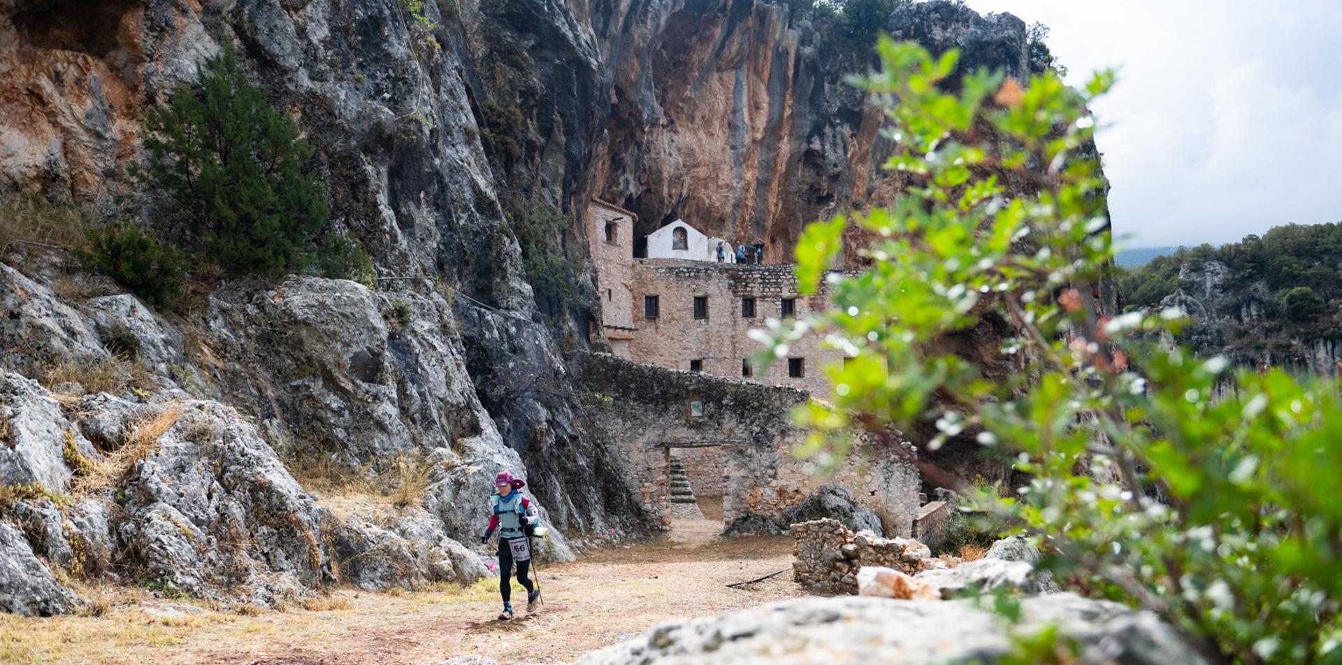
Greece is an open-air museum, and you will get to experience this through the race with glimpses of ancient ruins, forgotten temples, hidden archaeologic sites, medieval churches, huge caves, remnants of civilizations long past, and places that have a name in history such as Olympia and Sparta.
The landscapes are as dramatic as the stories they inspired – trails weaving through olive groves, along the sea, through hidden ravines, and climbs to reach staggering views of mountains, rolling countryside and the Aegean Sea.
Each Stage of RacingThePlanet is a step through history.
MAP
 Fixed.jpg)
STAGE DISTANCES

Stage 1: From Sea to Summit. Rocky uphill climb to Langada pass (1310m) in the Taygetos range. Leaving Kardamyli, the landscape will change to be forest and canyons with beautiful views of Taygetos Peak (the highest point in the Peloponnese).
Stage 2: In the Footsteps of the Spartans. Short climb up to the highest point of the course at 1,600 meters / 5,200 feet before descending the Taygetos range using dust roads and beautiful single tracks. Then entering the Parnon Range.
Olive trees and amazing views of the two mountain ranges with Sparta in the south east.
Stage 3: The Heart of Greece. Climbing in the Parnon range between olive trees and vineyards on nice trails and dust roads. You will go onto part of E4, the longest European Hiking Trail which stretches from Gibraltar to Cyprus.
This area is a unique chance to enjoy the real life of the ancient olive farmers in areas that are not visited by tourists.
Stage 4: Along the Train Tracks. Mixed terrain with dust roads, rocky parts, small sections of asphalt road and finally on abandoned train tracks, avoiding bridges on single track trails. You will go past the original Caryatids (Karies) – these are large columns like the ones made famous in Parthenon. The landscape is amazing with lots of changes and includes going through some nice villages and past small chapels and abandoned train stations.
Stage 5: Caves & Temples. This Stage is truly amazing, starting with a boat transfer to go from one “finger” of the Peloponnese to another. From a river, the course climbs a small hill and passes a marble quarry before a big climb up a jeep track to arrive at one of the most amazing monasteries at the top with stunning views. From there it is a dust road through a valley with small up and down climbs to Didyma, the location of two caves. Finally, on dust roads through small villages to arrive at the campsite in Ermioni on the Aegean Sea.
Stage 6: Final Footsteps.
ELEVATION
.jpg)
THE LONG MARCH
The Long March is a Stage where competitors complete a longer distance of approximate 80 kilometers / 50 miles which is nearly double the length of the standard Stages.
The Stage follows the same format as the previous Stages, with checkpoints located every 10 kilometers / 6 miles. However, there is a designated "Overnight Checkpoint" where there will usually be tents to rest / sleep in and also hot water available to prepare a hot meal or hot drinks. Competitors may follow highly reflective tape if required to navigate through the night.
CUT-OFF TIMES
A cut-off time is the time by which you must have left a checkpoint.
There are cut-off times for every checkpoint on the course - these are announced in the morning briefing before the start of each Stage. The cut-off times are designed to help you finish, not to stop you from finishing the race.
While the leaders are extremely fast (finishing 40 kilometers / 26 miles in 3-4 hours) the cut-off times for the back of the field are based on a 4 km per hour / 2.5 miles per hour walking speed. This means completing a 40 kilometer / 26 mile stage in 10 hours.
Cut-off times for The Long March are based on a similar speed but with additional time allowed for a rest at the Overnight Checkpoint.