


 Newsletter
 Online Store
 Login
Login


Race Coverage

RACE Coverage
RacingThePlanet: Brazil 2027 COURSE DESCRIPTION
RacingThePlanet: Brazil starts on 15 August 2027.
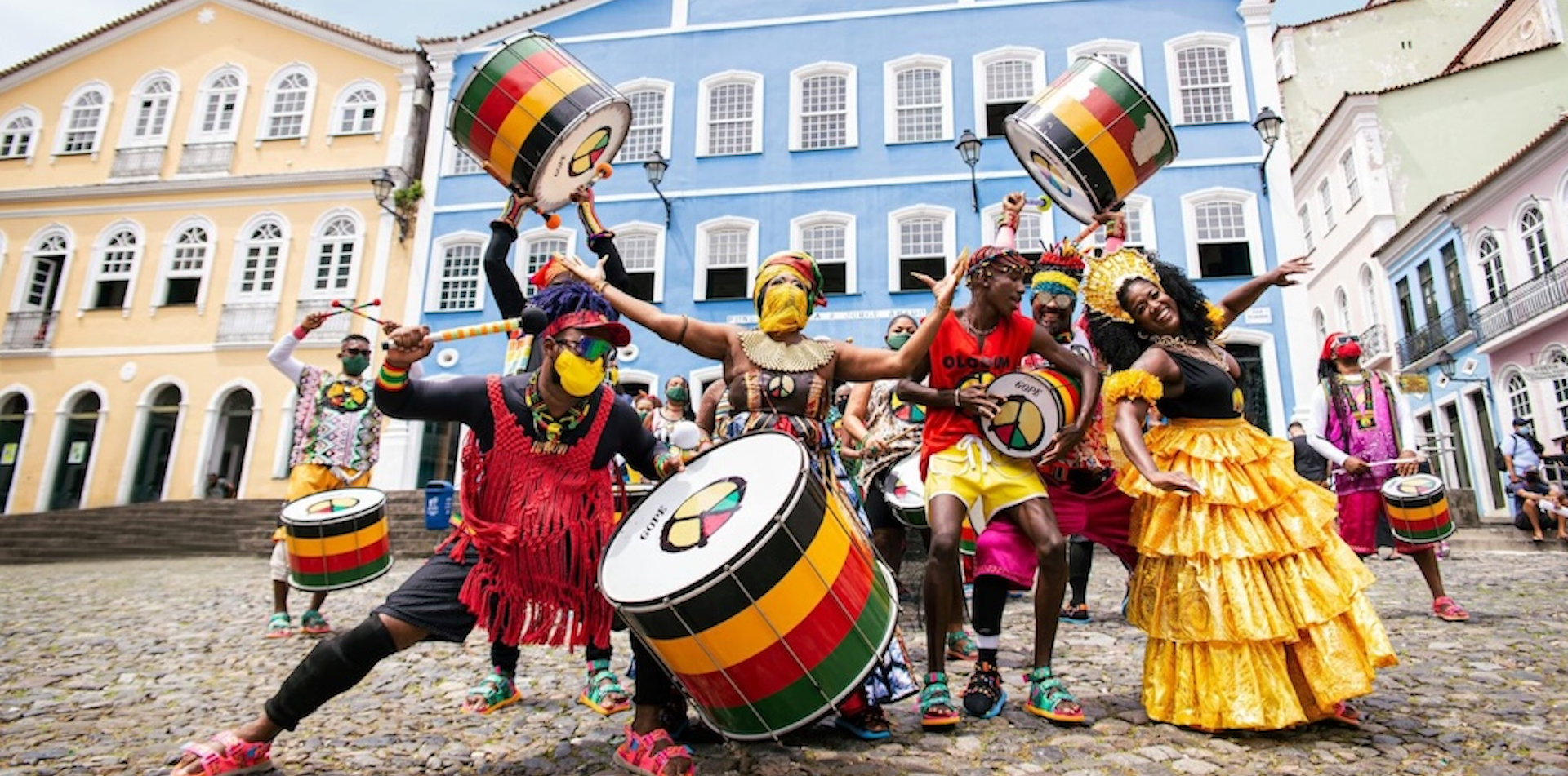
Get ready for an immersion into Brazil through landscapes, history, and rhythm in the natural paradise of Chapada Diamantina over the 250km, 6-Stage course. You can expect towering plateaus, hidden canyons, spectacular waterfalls, mineral-rich rivers, dirt roads through small villages, all connected by trails and dust roads. More detail on the course can be seen below including a map, Stage distances, the elevation profile, details about the terrain, checkpoints, cut-off times, and The Long March which is Stage 5. Final course notes will be given to each person in Brazil at the competitor check-in before the race.
COURSE MAP
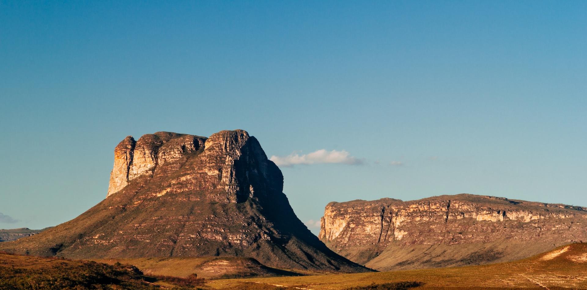
The course will take place in the Chapada Diamantina region. It starts near the town of Ibicoara and finishes in the old town of Igatú which is known as the “Machu Picchu” of Brazil.
.jpg)
.jpg)
STAGE DISTANCES
The distance for each of the Stages of RacingThePlanet: Brazil can be seen below. The Long March is on Stage 5 and will take place over two days.

ELEVATION
The highest point of the course is 1,037 meters / 3,402 feet – this is on Stage 1.
The lowest point on the course is 321 meters / 1,053 feet
- Total Elevation Gain: 5,273 meters / 17,300 feet
- Total Elevation Loss: 5,239 meters / 7,200 feet
The overall amount of climbing is manageable, but there are some steep ascents and descents.
.jpg)
TERRAIN
The scenery and terrain is very diverse as you experience the different biomes that are unique to Chapada Diamantina:
- Mata Atlantica – rain forest – in the canyons. Green.
- Cachinga – dry, low thicker bushes. Brown.
- Cachinga is a dry biome with low thicker bushes which is unique to Brazil. It is characterised as a semi-arid, tropical dry forest or scrubland (xeric shrubland). The name originates from Tupi-Guarani, meaning "white forest" or "white woodland," because the vegetation loses its leaves during the long, dry season to conserve water, creating a whitish, grey landscape.
- Campo Rupestre – top of the flat mountains, lower (knee high) vegetation are various types.
You can expect dust roads, rocky paths with some more technical rocky sections, single tracks and sandy paths through red, black and white soil and dust.
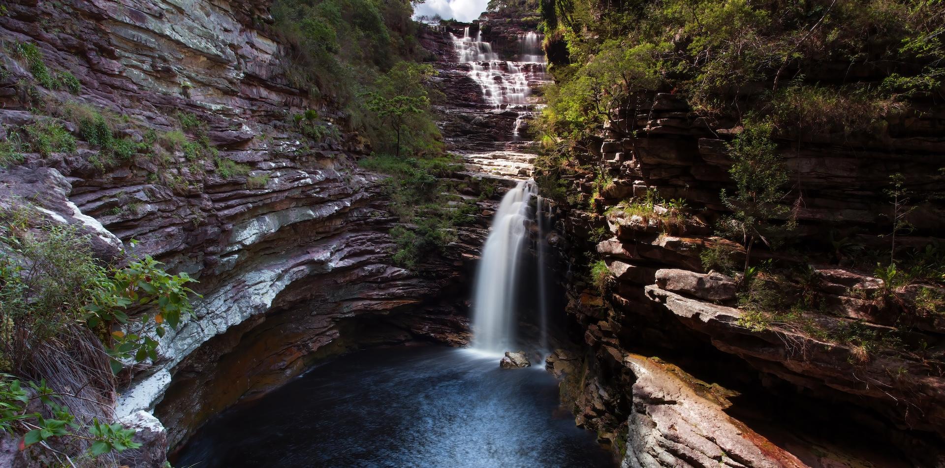
There are river crossings on almost every Stage, but some are very minor where you may be able to keep your feet dry. Water in the rivers is Coca-Cola color due to the type and amount of minerals in the water, but it is totally drinkable. Eventually you can find foam in the places where the water is more turbulent. That is far from pollution; on the contrary, it is because of the purity of the liquid that it creates foam.
- On Stage 3 you will follow the river for 9km / 6 miles.
One of the main highlights will be waterfalls. You will encounter one or several waterfalls on almost every Stage. Some will be higher than others but they are all amazing.
You will also cross small villages where you can experience local daily life in rural Brazil and overall, the kindness of the people living there.
CHECKPOINTS
During each Stage, checkpoints are located approximately every 10 kilometers / 6 miles along the course. All checkpoints include shade, water for drinking (normally from a large bottle that you can fill your bottles from), volunteers to check you in and offer support, and medical staff.
At each checkpoint competitors must:
- Be checked in on arrival by the race staff.
- Leave with the minimum allocation of drinking water for the next section (in general this is 1.5 liters).
- Listen to and adhere to any instructions given by the race staff. This could be related to anything including adverse weather conditions (rain, strong winds, thunderstorms, intense heat) or anything else.
At each checkpoint competitors can:
- Rest for a short time and take advantage of the shade the checkpoint tent offers.
- Seek medical advice and minor treatment if appropriate from the medical doctor stationed at each checkpoint.
- Ask details about the distance, terrain and elevation of the next section of the course.
Please note that adverse weather conditions, new obstacles or similar can result in changes being made to the course.
THE LONG MARCH
On one Stage competitors complete a longer distance of approximately 80 kilometers / 50 miles which is nearly double the length of the standard Stages. This Stage is known as The Long March.
The Stage follows the same format as the previous Stages, with checkpoints located every 10kms / 6 miles. There is a designated "Overnight Checkpoint" around halfway where there will be tents to rest / sleep in and also hot water available to prepare a hot meal or hot drinks.
The cut-off times will be extended to allow those at the back of the field to have 3+ hours' rest.
CUT-OFF TIMES
A cut-off time is the time by which you must have left a checkpoint. There are cut-off times for every checkpoint on the course - these are announced in the morning briefing before the start of each Stage. They are designed to help you finish, not to stop you.
The leaders are extremely fast (finishing a 40 kilometer / 26 mile Stage in 3-4 hours).
The cut-off times for the back of the field are based on a 4 km per hour / 2.5 miles per hour walking speed.
- This means completing a 40 kilometer / 25 mile stage in 10 hours.
- It is possible to walk the entire course and still finish.
Cut-off times for The Long March are based on a similar speed but with additional time allowed for a rest at the Overnight Checkpoint.