


 Newsletter
 Online Store
 Login
Login


RACE INFO

RACE INFO
Potential Course Locations
Below are some Quick Facts for several potential locations where the races may take place, highlighting wildlife, landmarks, history, and the unique character of each site. Most areas will be snow‑covered in November, though conditions can vary. At Deception Island, for example, geothermal activity can melt fresh snow within hours, creating an otherworldly contrast that runners never forget.
Each location brings its own spectacular personality, and together they shape the unforgettable experience that defines The Last Desert and the Antarctica Ultramarathon.
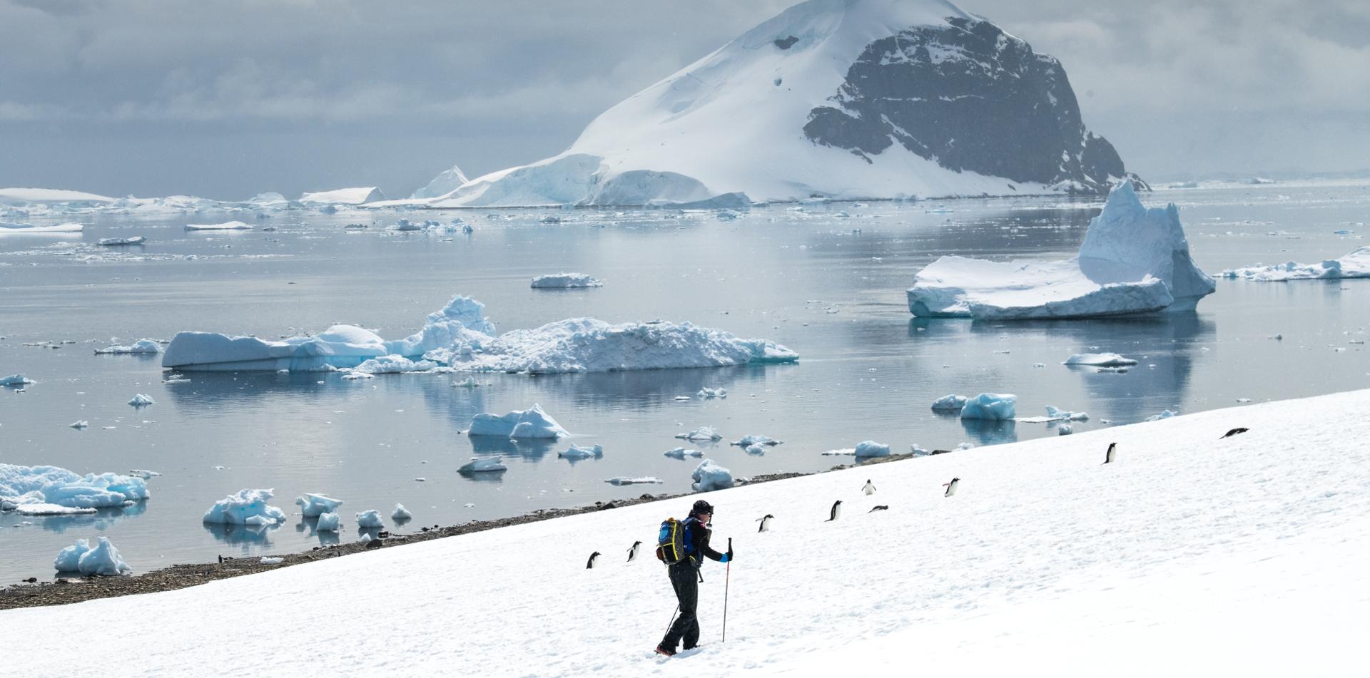
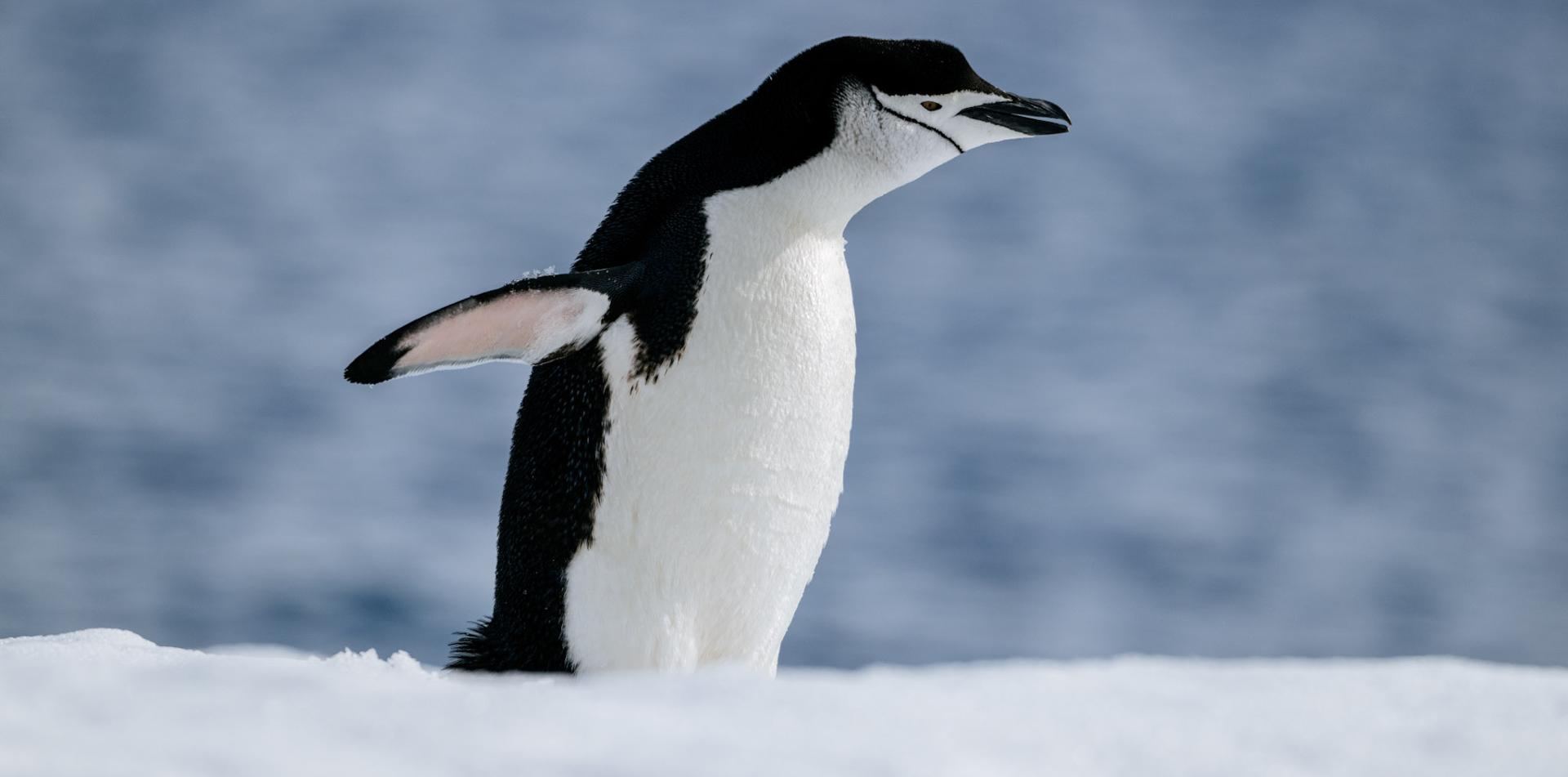
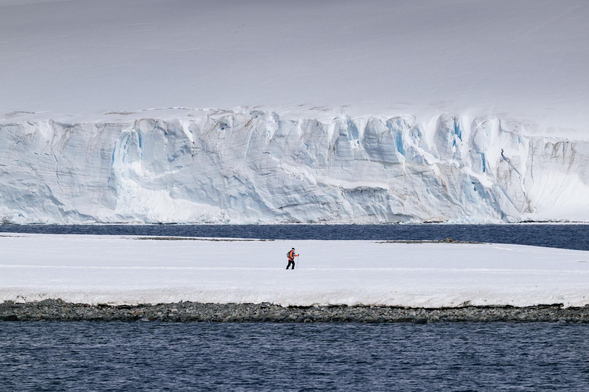
1. HALF MOON ISLAND
Position: 62°35′24″S / 59°54′36″W
- Crescent‑shaped island in the South Shetland Islands
- Rocky beaches, steep slopes, and volcanic outcrops
- Wildlife: Chinstrap penguins, terns, shags, skuas, seals
- Home to Argentina’s summer‑only Cámara Station
- Historic whaling dory on the landing beach
- Featured in The Last Desert: 2016, 2024
- 2016: a competitor was married here
- 2024: hosted the inaugural Antarctica Ultramarathon
.jpg "HALF MOON ISLAND")
2. DECEPTION ISLAND
Position: 62°58′37″S / 60°39′00″W
- Circular volcanic island, 12 km wide; highest point Mt. Pond (542 m)
- Formed by a collapsed volcano that created a flooded caldera
- Wildlife: Chinstrap penguins, pintado petrels, Antarctic terns
- Famous horseshoe shape with safe natural harbour at Port Foster
- Active volcano; last eruption in 1991–92
- Pendulum Cove features naturally heated volcanic waters
- Featured in The Last Desert: 2006, 2007, 2010, 2014, 2016, 2022, 2024
.jpg "DECEPTION ISLAND")
3. DORIAN BAY / DAMOY POINT
Position: 64°48′S / 63°30′W
- Located on Wiencke Island in the Palmer Archipelago
- Landing area: sandy beach with polished glacial rocks
- Two huts on site: British refuge hut and Argentine hut
- Terrain includes a gentle hilltop and a steep slope leading to a glacier
- Featured in The Last Desert: 2010, 2016, 2018, 2022, 2024

4. ESPERANZA
Position: 63°24′S / 56°59′W
- Antarctic mainland
- Argentine research station in Hope Bay, established 1952
- One of the few Antarctic bases with families and teachers
- Nearby: remains of 1903 Swedish expedition hut
- Wildlife: Adelie penguins, snowy sheathbills
- Birthplace of the first person born in Antarctica
- Hosted the first‑ever 100‑mile stage of The Last Desert in 2006, and the first-ever 100-mile ultramarathon in Antarctica

5. CUVERVILLE ISLAND
Position: 64°41′S / 62°38′W
- Located in the Errera Channel, between the Arctowski Peninsula and Rongé Island
- Discovered by the Belgian Antarctic Expedition (1897–99), led by Adrien de Gerlache
- Named after French Vice Admiral Jules de Cuverville
- About 2.5 km long, with steep rocky slopes and snow patches
- Hosts the largest gentoo penguin colony in Antarctica (approx. 6,500 breeding pairs)
- Other wildlife: Skuas, snowy sheathbills, blue‑eyed shags, Wilson’s storm petrels
- Surrounded by dramatic icebergs drifting through the Errera Channel
- Designated as an Important Bird Area (IBA) by BirdLife International
- Featured in The Last Desert 2008

6. PORTAL POINT
Position: 64°30′S / 61°46′W
- Antarctic mainland
- Located on the Reclus Peninsula, west coast of Graham Land
- Site of British Station “P” (1956–1958); hut later removed, cairn and plaque remain (HSM 60)
- Terrain: low ice‑free point with rocky ground, snow patches, and views across Charlotte Bay
- Wildlife: limited, but gentoo penguins, skuas, and seals may be seen nearby
- Scenic highlight: panoramic views of surrounding glaciers and mountains
- Part of The Last Desert 2024

7. STONY POINT
Position: 64°54′45″S / 62°56′05″W
- Located on the southern coastline of Paradise Harbour, between Oscar Cove and Sturm Cove
- Small rocky headland with a snow‑covered peak most of the season
- Rocky shoreline; shallow approaches require careful navigation
- Panoramic views of Paradise Bay, Skontorp Cove, and Bryde Island peaks
- Wildlife: minimal compared to other Peninsula sites; suitable for controlled overnight stays
- Nearby sites: close to Brown Station (Argentina) and Skontorp Cove
- Part of The Last Desert: 2018, 2022

8. AITCHO ISLAND
Position: 62°24′S / 59°47′W
- Part of the South Shetland Islands, at the north entrance to English Strait
- Name “Aitcho” comes from phonetic spelling of H.O. (Hydrographic Office)
- Landscape: steep cliffs (up to 70 m), black sand and cobbled beaches, basalt outcrops
- Wildlife highlights:
- Gentoo penguins and chinstrap Penguins (breeding colonies)
- Other birds: Kelp gulls, skuas, sheathbills, shags, storm petrels
- Marine mammals: Elephant seals, fur seals, occasional leopard seals
- Vegetation: mosses, lichens, Antarctic hair grass (Deschampsia antarctica)
- Historic artefacts from sealing operations remain on site
- Part of The Last Desert 2008
9. KING GEORGE ISLAND
Position: 62°02′S / 58°21′W
- Largest of the South Shetland Islands
- Hosts many international research stations (Polish, Brazilian, Russian, Chilean, Chinese, Korean, Uruguayan)
- It contains an active airstrip used in The Last Desert 2006
- Featured in The Last Desert: 2006, 2010, 2012, 2016, 2018
1.jpg "KING GEORGE ISLAND")
10. NEKO HARBOUR
Position: 64°50′S / 62°33′W
- Antarctic mainland
- Located on Andvord Bay, west coast of Graham Land
- Named after the Norwegian whaling ship Neko
- Known for dramatic glacier calving and stunning scenery
- Course includes a significant hill climb
- Featured in The Last Desert: 2007, 2008, 2012
11. PARADISE BAY
Position: 64°54′S / 63°32′W
- Antarctic mainland
- Beautiful natural harbour on the Antarctic Peninsula
- Home to Argentina’s Almirante Brown Base and Chile’s González Videla Base
- Argentine base rebuilt after a 1984 fire; used only in summer
- Featured in The Last Desert: 2006, 2016, 2018

12. PETERMANN ISLAND
Position: 65°10′S / 64°10′W
- Small 2 km island near the Lemaire Channel
- Southernmost gentoo penguin colony; also adelie penguins
- Named by German expedition (1873–74)
- Historic French expedition site (1908–10)
- Argentine refuge hut and memorial cross still present
- Featured in The Last Desert: 2008, 2022

13. DANCO ISLAND
Position: 64°44′S / 62°37′W
- 2 km island in the Errera Channel
- Known for glaciers, gentoo penguins, and scenic views
- Named after Belgian geophysicist Emile Danco
- Former site of British Station O (1956–1959)
- Featured in The Last Desert: 2012, 2014, 2016, 2018, 2022, 2024
.jpg "DANCO ISLAND")
15. PORT LOCKROY
Position: 64°49′S / 63°29′W
- Historic British base and natural harbour
- Used for whaling, WWII operations, and research until 1962
- Restored in 1996; now a museum and post office
- Protected as Historic Site No. 61
- Visitors can send postcards from Antarctica
- Weather permitting, we will visit this location during the race. If the weather is inclement, we will invite staff to join us for dinner on the M/V Plancius. The staff will also be invited to take part in one Stage of The Last Desert with us.

16. MICHELSON ISLAND
Position: 60°43′59″S / 45°01′59″W
- Small rocky island in the South Orkney Islands, joined to Powell Island by a narrow isthmus
- Roughly charted by Powell and Palmer in 1821 during sealing voyages
- Named Michelsens by Norwegian whaler Sørlle in 1912; re‑charted by the Discovery Investigations in 1933
- Designated as part of Specially Protected Area No. 15 (SPA 15) in 1967 under the Antarctic Treaty System
- Landscape: low elevation, rugged coastline, narrow isthmus sometimes submerged at high tide
- Wildlife: seabirds (petrels, skuas, gulls), occasional seal haul‑outs; vegetation limited to mosses and lichens
- Featured in The Last Desert 2018
17. ORNE ISLAND
Position: 64°40′S / 62°40′W
- Small island located at the entrance to the Errera Channel, near the west coast of Graham Land
- Discovered by the Belgian Antarctic Expedition (1897–99) led by Adrien de Gerlache
- Named after Norwegian whaler Orne
- Landscape: steep rocky slopes rising to about 40 m, with snow cover most of the season
- Wildlife:
- Chinstrap penguins (breeding colony)
- Occasional gentoo penguins and seabirds such as skuas and sheathbills
- Scenic highlights: panoramic views of the Errera Channel, Ronge Island, and surrounding glaciers
- Uninhabited
- Featured in The Last Desert 2022
